

Stanley Park, Vancouver
Stanley Park Seawall: Vancouver’s Classic Waterfront Loop
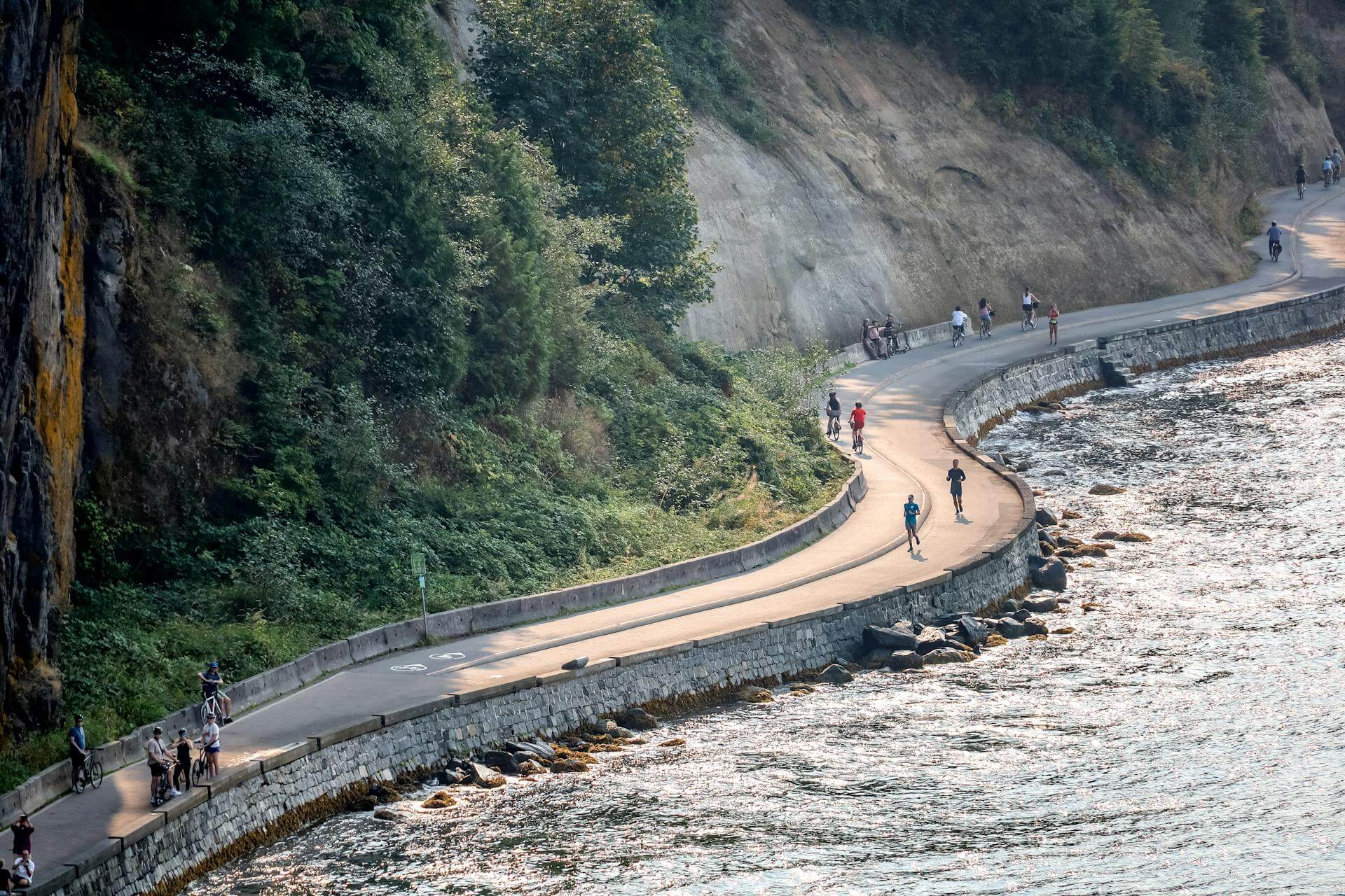
The Stanley Park Seawall is one of Vancouver’s most scenic walks and bike rides, wrapping around the edge of Stanley Park with ocean views, forested cliffs, beaches, public art, city skyline views, and the North Shore mountains across the water.
This is the route many visitors picture when they think of Vancouver: a paved waterfront path, fresh ocean air, tall trees, and postcard views around nearly every curve.
Why the Stanley Park Seawall is worth visiting
The Seawall is more than a path around the park. It is a full Vancouver experience in one route. The loop passes Coal Harbour, Brockton Point, the Totem Poles area, forested waterfront sections, Lions Gate Bridge views, Siwash Rock, Third Beach, Second Beach, and the edges of English Bay.
Visitors can walk the full loop, bike it in one steady ride, or enjoy a shorter section near Coal Harbour, Second Beach, or Third Beach. The path is paved and easy to follow, with ocean views for much of the route.
Good to know before starting
Travel on the Stanley Park Seawall is one way, counter-clockwise. Walkers and runners generally stay closest to the water, while cyclists and inline skaters follow the inside path where lanes are separated. Follow posted signs, especially on sunny weekends when the route gets busy.
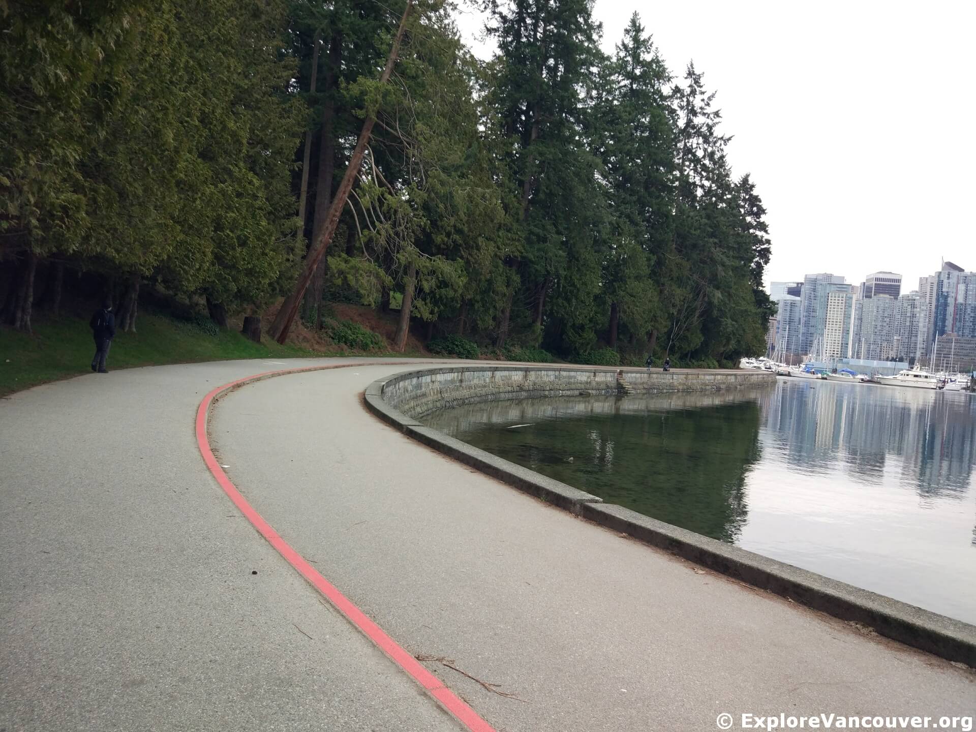
The Seawall follows the edge of Stanley Park with wide water views and easy access to many park landmarks.
Route at a glance
A popular starting point is near Coal Harbour on the east side of Stanley Park Drive. From there, the loop travels counter-clockwise around the park. Visitors can also start near Second Beach, English Bay, or one of the nearby park entrances, but the one-way direction still matters for cyclists.
- Start near Coal Harbour and Stanley Park Drive for skyline and marina views.
- Continue toward the Vancouver Rowing Club and the Nine O’Clock Gun.
- Pass Brockton Point and the Totem Poles area.
- Follow the waterfront past forested cliffs and views toward the North Shore.
- Continue under the Lions Gate Bridge area and look for Siwash Rock along the western edge of the park.
- Reach Third Beach, one of the best places to pause near sunset.
- Continue toward Second Beach, then return toward English Bay, Lost Lagoon, or Coal Harbour depending on the route.
Best stops and viewpoints along the Seawall
Coal Harbour views
The eastern side of the loop gives visitors a beautiful opening stretch with downtown towers, marinas, and North Shore mountain views.
Brockton Point and Totem Poles
This is one of the most visited areas of Stanley Park, with open waterfront views and easy access to the famous totem poles nearby.
Lions Gate Bridge views
The northern and western sections of the route bring dramatic views of Lions Gate Bridge, Burrard Inlet, and the forested edge of the park.
Third Beach and Second Beach
These beach areas are great places to slow down, take a break, watch the water, or add more time in Stanley Park before leaving.
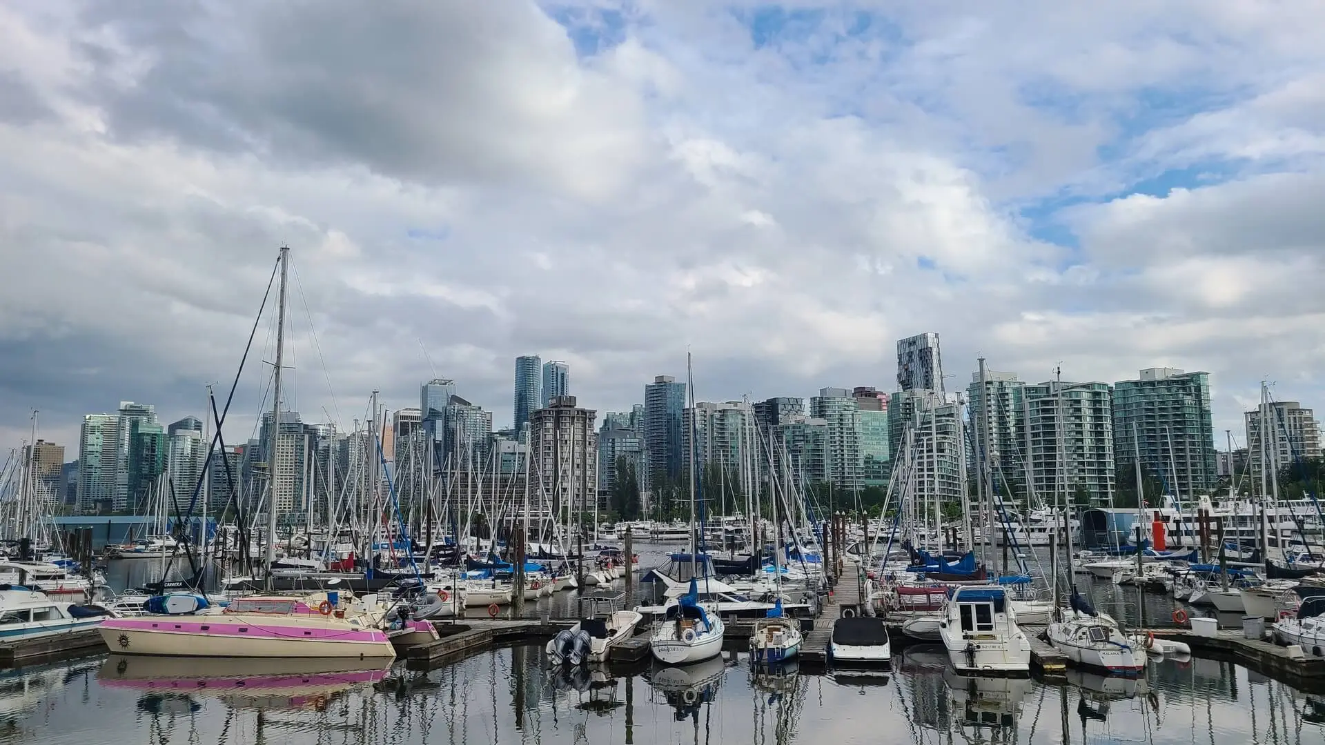
City and mountain views are part of the classic Seawall experience.

The Totem Poles area is close to the Seawall near Brockton Point.
Walking the Stanley Park Seawall
Walking the full loop is a relaxed half-day outing for many visitors. The route is mostly flat, paved, and easy to follow, but it is still a long walk. Comfortable shoes, water, and weather-appropriate layers make the route more enjoyable.
For a shorter visit, start near Coal Harbour and walk toward Brockton Point, or start near English Bay and walk toward Second Beach and Third Beach. Both options offer great views without needing to complete the full loop.
Cycling the Stanley Park Seawall
Cycling the loop is one of the easiest ways to see a lot of Stanley Park in a shorter visit. Bikes must follow the counter-clockwise direction on the Seawall, and riders should watch for slower traffic, tight corners, and busy areas around beaches and viewpoints.
On sunny weekends, the path can get crowded. A morning ride is usually calmer than mid-afternoon, especially during summer and long weekends.
Accessibility
The City describes the Stanley Park Seawall walk as wheelchair accessible, with a concrete surface and a mix of separated and shared path sections. Visitors should still check current conditions before going, because weather, maintenance, special events, or winter slope work can affect parts of the route.
Getting to the Stanley Park Seawall
By transit
TransLink’s #19 bus serves Stanley Park, with stops near Lost Lagoon and Stanley Park Loop. There is no public transit service around the full park loop, so plan the route before starting.
By bike or on foot
Visitors coming from downtown can reach the park through Coal Harbour, the West End, or English Bay. The waterfront approach from Coal Harbour is one of the most scenic ways to arrive.
By car
Stanley Park has paid parking year-round. Daily parking passes can be useful for visitors planning to move between different park areas during the same visit.
Park hours
Stanley Park is generally open from 6am to 10pm unless otherwise posted. Washrooms are generally available from dawn until dusk.
Map
This map points to the Stanley Park Seawall area. Check the official City map or posted park signage for closures, detours, washrooms, and current route details before going.
Pair it with nearby Stanley Park stops
The Seawall is easy to combine with other Stanley Park places, especially if visitors are already spending a few hours in the park.
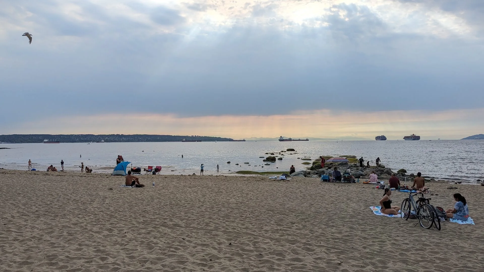
Third Beach is one of the most popular pause points along the western side of the Stanley Park Seawall.
Before you go
Check current information before visiting, especially during winter maintenance periods, major events, heavy rain, windstorms, or construction. The City notes that winter slope stabilization can temporarily close sections between Prospect Point and Third Beach, with detours posted in the park.
Smoking is not allowed in Vancouver parks, on seawalls, or on beaches. Open fires are also not permitted in Stanley Park. Visitors should stay on designated paths, follow posted signs, and pack out anything brought into the park.
FAQ about the Stanley Park Seawall
How long is the Stanley Park Seawall loop?
The Stanley Park Seawall loop is about 10 km. Many visitors allow 2 to 3 hours to walk it at a relaxed pace, while cycling can take about 1 hour without long stops.
Which direction should visitors travel on the Stanley Park Seawall?
Travel is one way, counter-clockwise, around Stanley Park. Cyclists should follow the posted direction and lane markings.
Where is a good place to start?
A popular starting point is near Coal Harbour on the east side of Stanley Park Drive. Visitors can also start near English Bay, Second Beach, or other park access points.
Is the Stanley Park Seawall wheelchair accessible?
The City describes the Stanley Park Seawall walk as wheelchair accessible, with a concrete surface and both mixed and separated path sections. Always check current conditions before visiting.
Can visitors bike the Stanley Park Seawall?
Yes, cycling is allowed, but riders must follow the one-way counter-clockwise direction and stay in the correct lane where paths are separated.
Is there parking near the Stanley Park Seawall?
Yes, Stanley Park has paid parking year-round. Parking can fill quickly during sunny weekends, holidays, and major events.